This trail goes by a few names — the Tushemisht Ridge, the Ohrid Highlands Trail — and like most hikes we've done around Pogradec, it had a little bit of everything. Steady climbs and flat stretches, wide-open ridgelines and sections of dense forest, moments of total clarity and moments of complete disorientation. And, as always, views of Lake Ohrid that stop you in your tracks.
This isn't a polished trail guide. It's what actually happened, because I think that's more useful to you.
Distance and time will vary depending on which trails you take, how far you go, and conditions on the day. Your experience could be significantly shorter or longer than ours.
The Highway Problem at the Trailhead
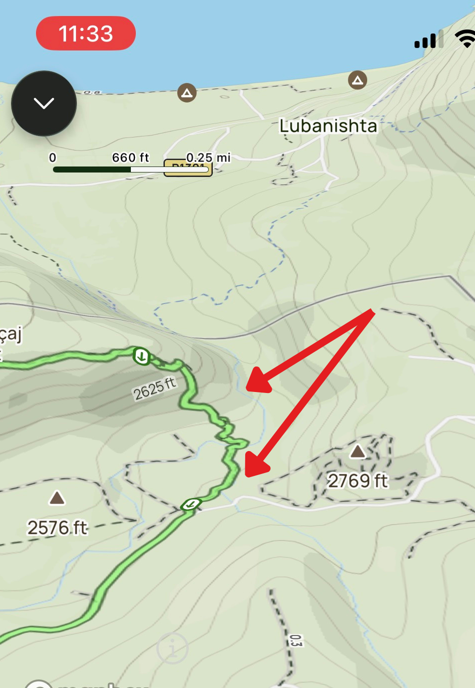
Here's the first thing you need to know, because nothing on the map warns you about it: the beginning of the trail has been cut off by a new highway.
If you walk through Tushemisht you'll spot trail signs and blazes that look perfectly legitimate. Follow them and you'll find yourself standing at the edge of a highway embankment, staring across at the trail continuing on the other side. Because of the depth of the cut, crossing there simply isn't feasible.
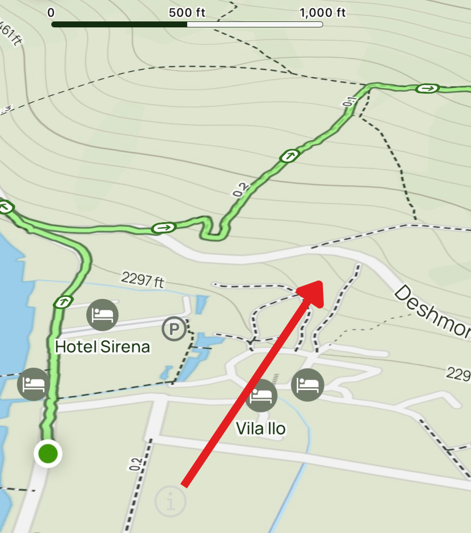
The workaround is simple once you know it: don't follow the old signs. Instead, head a little further up the road where the land slopes down enough to give you access onto the trail from a different angle. You can see in the photo above where the road cuts through the trail. The green line shows you how we got around it. Either way you approach it, you will need to walk along the highway for a few minutes before you get clear of it — it's unavoidable, so just take your time and be careful of the traffic.
Don't rely on the old trail markers in the village to guide you to the start. Use the photo above as your reference. Walk slightly further up the road until the bank slopes enough to step down onto the trail, then walk briefly alongside the highway to clear it. Once you're past that stretch, you're on your way.
A Web of Trails — and Why That Matters
The second thing to understand is that this isn't a single trail — it's a system. Looking at the map, you'll see branching paths heading off in multiple directions, and the reality on the ground is even more complex than that. Albania has centuries of pastoral tradition, and the sheep and goat herders who work these slopes have created their own routes for their own reasons. Many of those paths won't appear on any app.
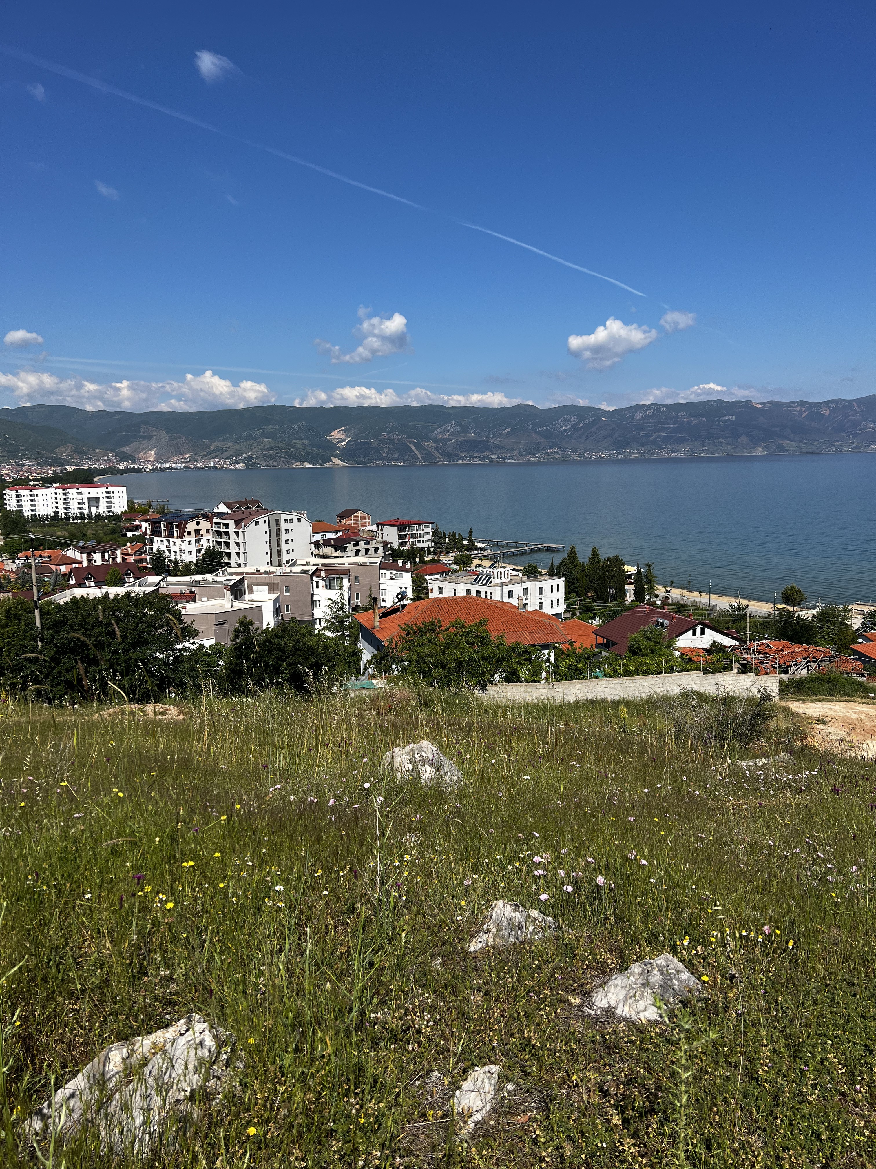
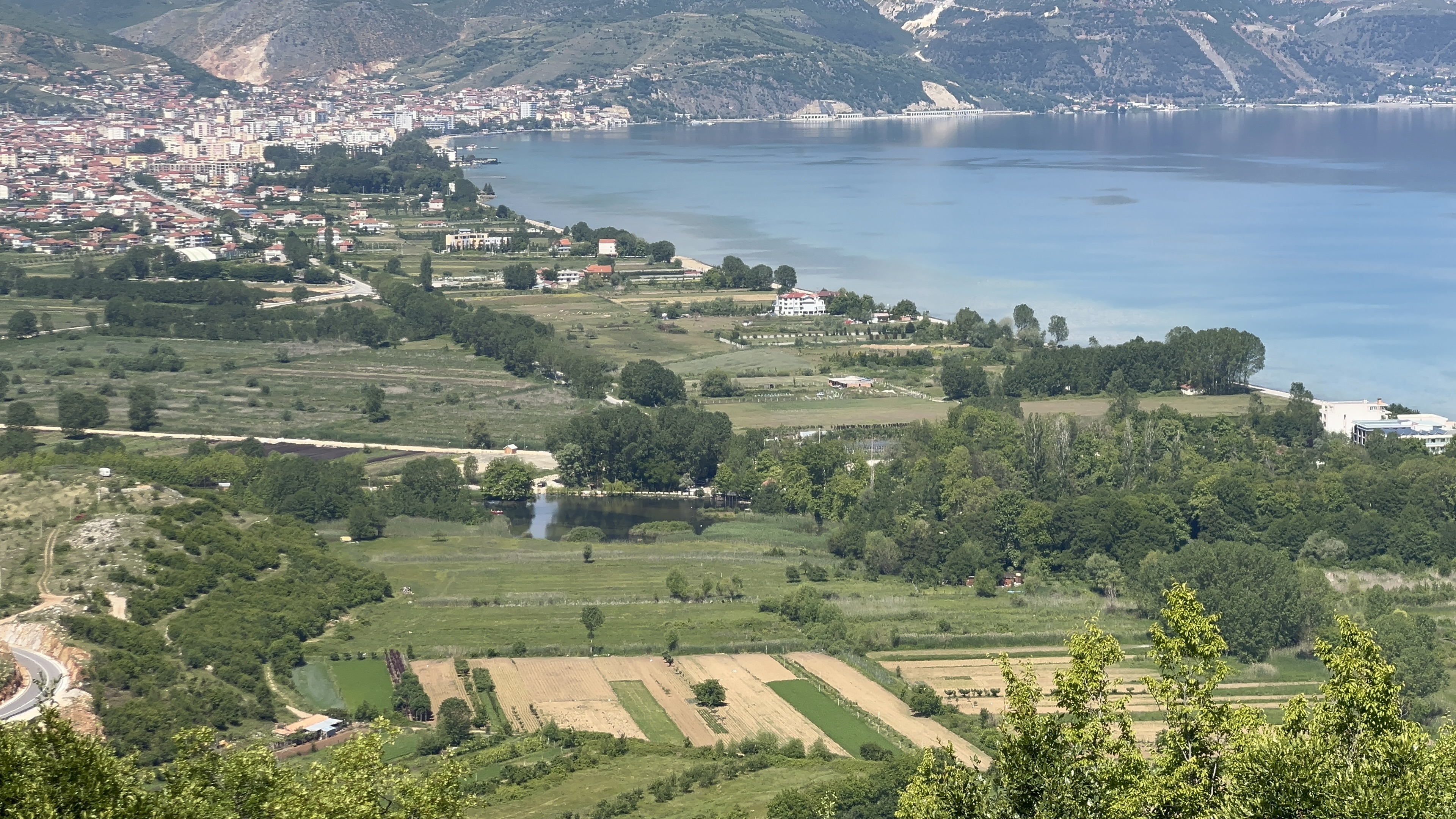
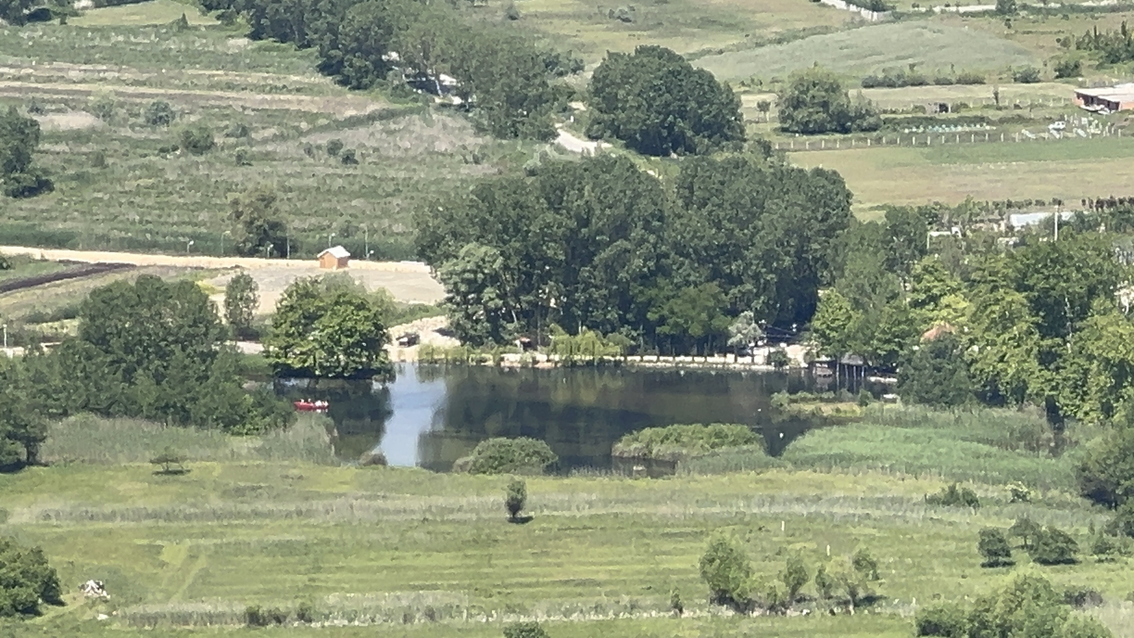
In the first section of the hike, this isn't a big problem. You're in open terrain, Lake Ohrid is visible behind you and the rooftops of Tushemisht are easy to pick out below. Even if you drift onto the wrong path, you can see enough of your surroundings to stay oriented. It's forgiving country.
Here's a screen recording of our AllTrails map so you can see the route we took and get a feel for the trail system:
Into the Trees — Where It Gets Real
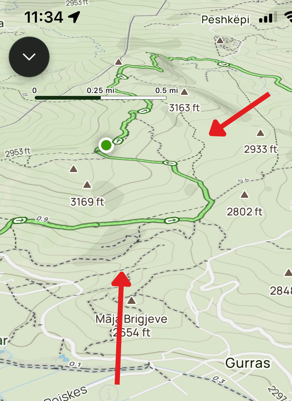
Things change when you enter the forest. The lake disappears, the village disappears, and your world narrows to the trees immediately around you. This is where good navigation starts to matter — and where we found out that the trails shown on AllTrails don't quite match what exists on the ground anymore. At least on the route we took.
We ended up bushwhacking for the better part of a mile. No trail, no markers, just dense undergrowth and the map on our phones telling us a path should be right here. It's humbling. Albania's forests are old and untended and they reclaim ground quickly.
What saved us was a stream. Towards the end of that stretch, the terrain began to slope downward and we picked up the sound of running water. Following it helped us orient to where we were on the map, and from there we were able to find a track that led us out to Gurras — a small village just outside of Tushemisht. From Gurras, we called a cab back into Pogradec.
We Didn't Make It to Peshkepi
Our original goal was to reach Peshkepi, the village further along the ridge. We didn't get there. The overgrown trails in the upper section cost us time and energy, and I had a pre-scheduled livestream to get back for. These things happen.
I mention this not as a complaint but as a useful data point. This trail takes longer than you might expect, especially if the upper section is as overgrown as it was when we did it. Build in extra time. Don't commit to a hard turnaround deadline. Come back for Peshkepi another day.
A Word About the Herder Dogs
We encountered aggressive dogs on this hike. The herder was nearby, called them off, and we were able to get through without incident — but it was a tense few minutes. This is not unusual. We've had similar encounters on multiple hikes around Pogradec. The dogs are doing their job; they're protecting the flock. They're not strays.
I always carry bear spray on hikes here. I've never needed to use it, and I hope I never do. But aggressive dogs are a real enough risk in these hills that it gives me peace of mind. You'll make your own call. At minimum, give any herd dogs a wide berth, move slowly and calmly, don't run, and let the herder manage the situation if they're nearby.
What Made It Worth It
You didn't read this far just to hear about highways and bushwhacking, so let me tell you about the good parts — and there were many.
The views of Lake Ohrid from this trail are unlike any you get from Pogradec itself. Down on the promenade the lake is enormous and you're inside it. Up here, you can see the shape of it — the way it fills the valley, the color of the water changing with the depth, the long curve of the Albanian shore and the mountains of North Macedonia on the far side. It's genuinely breathtaking, and it changes as you climb.
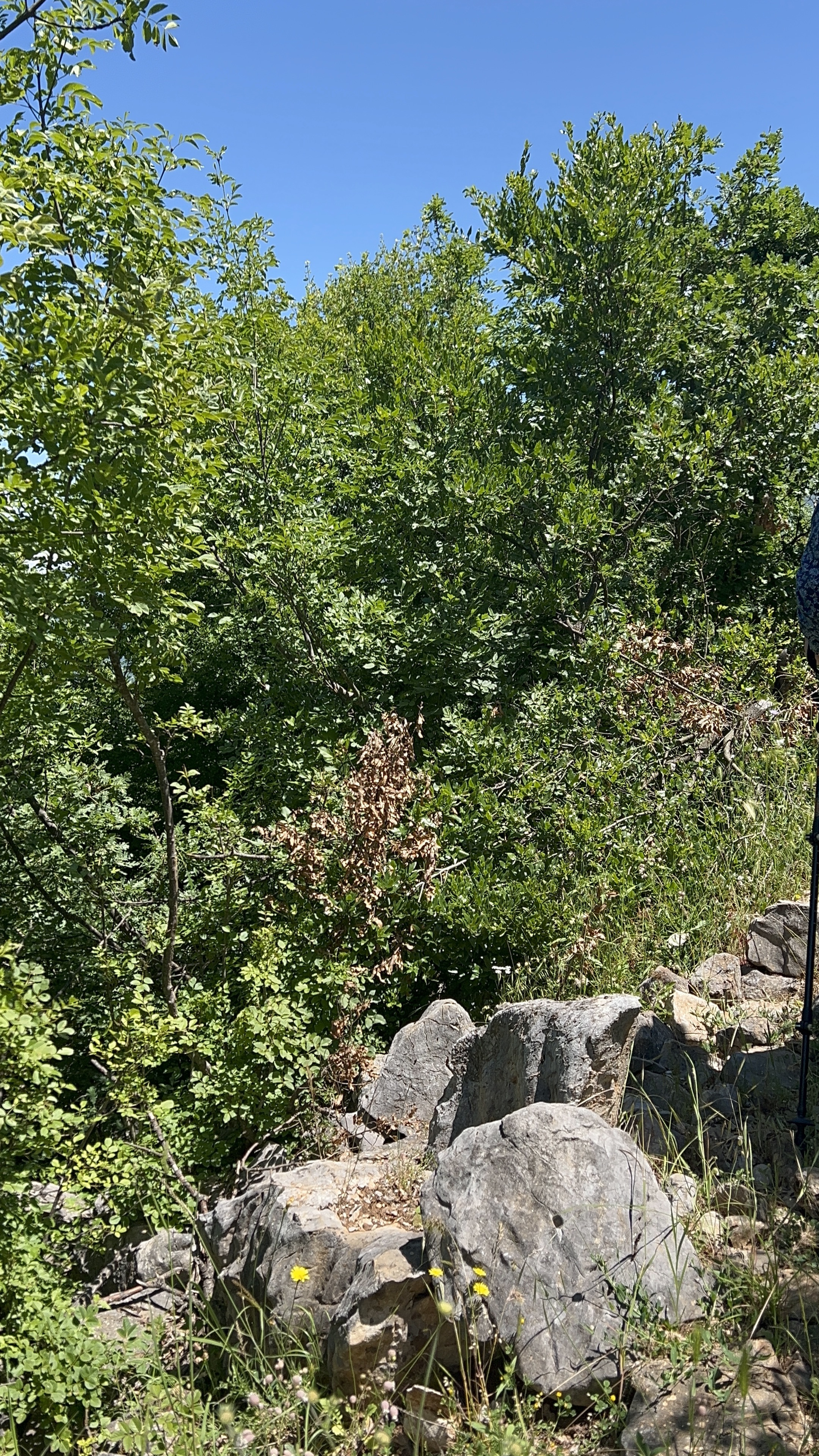
We also came across some unexpected structures along the route — remnants of something older, reclaimed by the hillside. I won't say more because I don't want to spoil the discovery. Look out for them in the open sections before the treeline.
My Honest Recommendation
The terrain on this trail is moderate to slightly challenging — the inclines are real but not extreme, and the open sections are genuinely beautiful. I enjoyed this hike. I'd do it again, but differently.
If you're an experienced navigator and comfortable in unmarked terrain: go for it. Download AllTrails and Maps.me before you leave, expect the digital trails to be approximate rather than exact in the upper section, and give yourself a full day.
If you're less experienced or hiking solo: I'd strongly recommend going with a group or a local guide, especially for the wooded upper section. Alternatively, stick to the earlier portion of the trail where you have good visibility of the lake and the village. The views from there are already excellent, and there's no shame in turning back when navigation gets hard.
Either way — carry a first aid kit, bring more water than you think you need, and don't commit to a fixed return time unless you know this trail well. The mountains around Pogradec reward patience.
Disclaimer
The trail conditions, route descriptions, and timings described in this post reflect one hike on one day and are not guaranteed to match what you'll find. Trails change. Conditions change. Navigation on unmarked terrain involves real risk. The author and the owner of this website accept no liability for any accident, injury, loss, or death arising from use of this information. You hike entirely at your own risk. Always carry a first aid kit. In an emergency, dial 112.